In an effort to better visualize the TBR-related places, I have attempted two different projects on GOOGLE EARTH.
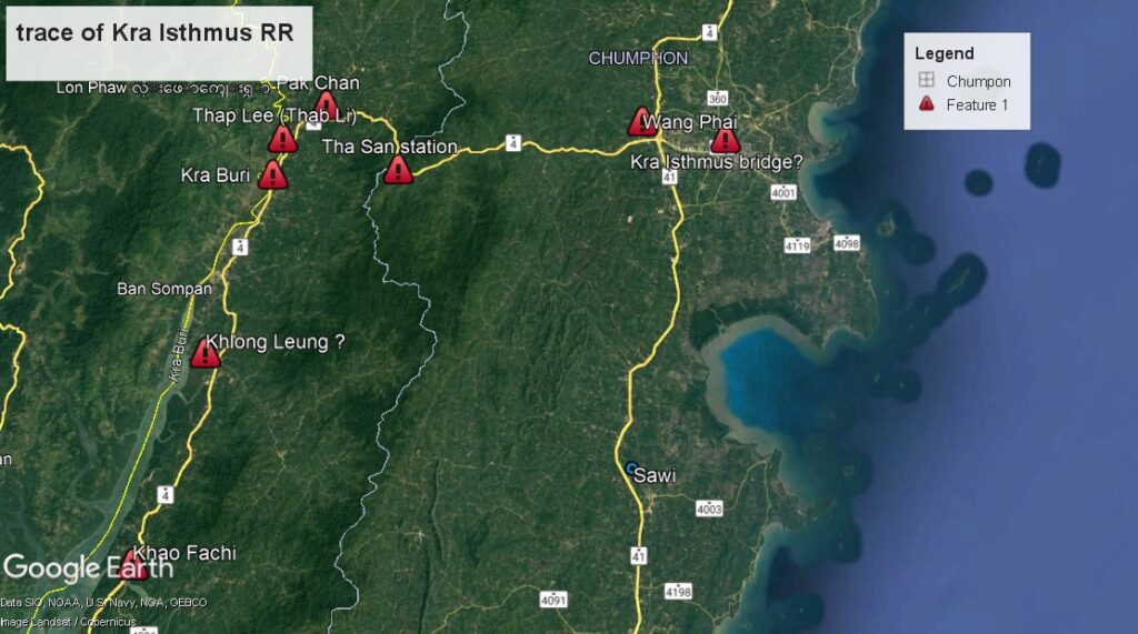
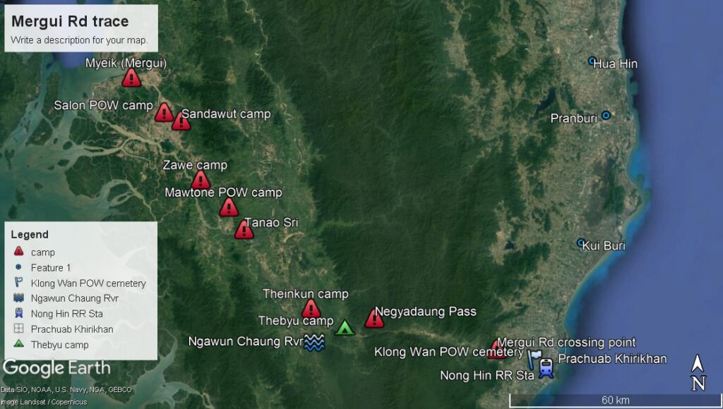
One was to construct a rough map of the various projects. These give an idea of the shape, distance and scope of the Kra Isthmus and Mergui Rd projects. The Kra Isthmus line roughly follows the trace of the current Highway #4. These markers were placed using current place and temple names in the area. They will remain rough estimates of the true locations of these camps and stations until a more precise rendering can be made. Should anyone know of a source of precise locations, please contact me.
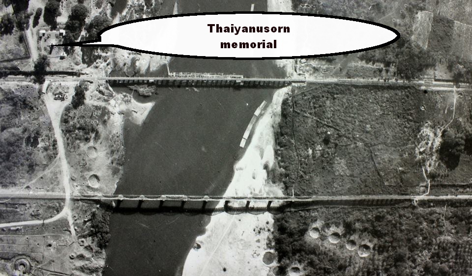
The second effort was much more fruitful. GE allows one to overlay photographs. I used era photo recon shots to overlay on the area. Using landmarks like the rail line, bridges and roads, it is not difficult to precisely align the photo. This gives an insight into what was evident in the mid-40s. Unfortunately, there are relatively few of these photos available and they are never dated. Due the the various features shown, one can place an approximate date; certainly a before or after date. For example,in the Bridge photos –of which there are many — the Thai-anusorn memorial can often be seen. This dates that photo as after the MAR 1944 dedication date.
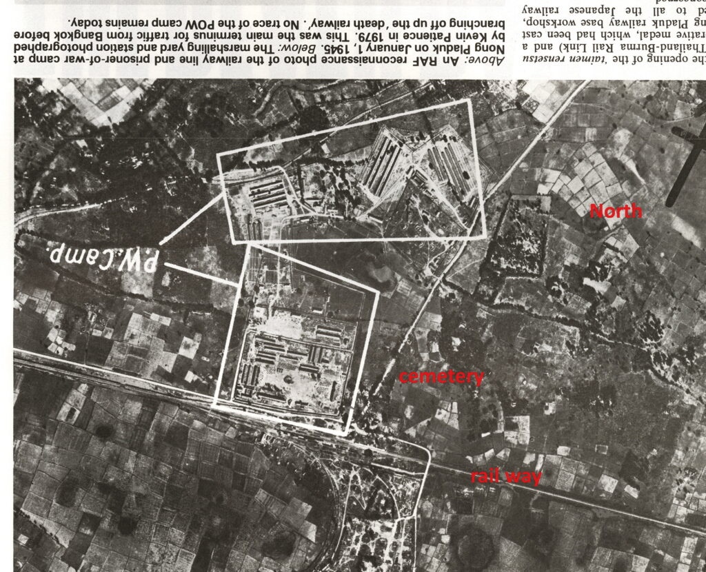
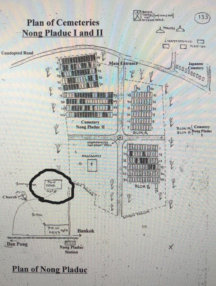
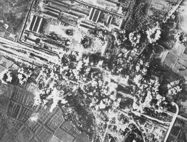
One site that was heavily photographed and bombed was the NongPlaDuk rail yard. The intelligence analysts annotated these photos with additional information. The cemetery area at NongPlaDuk is clearly delineated in the diagram, but never acknowledged on the recon photos. The first of the POW camps was established here in June 1942 housing mainly British POWs some of whom were later transferred to build the Mae Klong bridges. Post-construction, a second even larger camp housed many Dutch POWs.
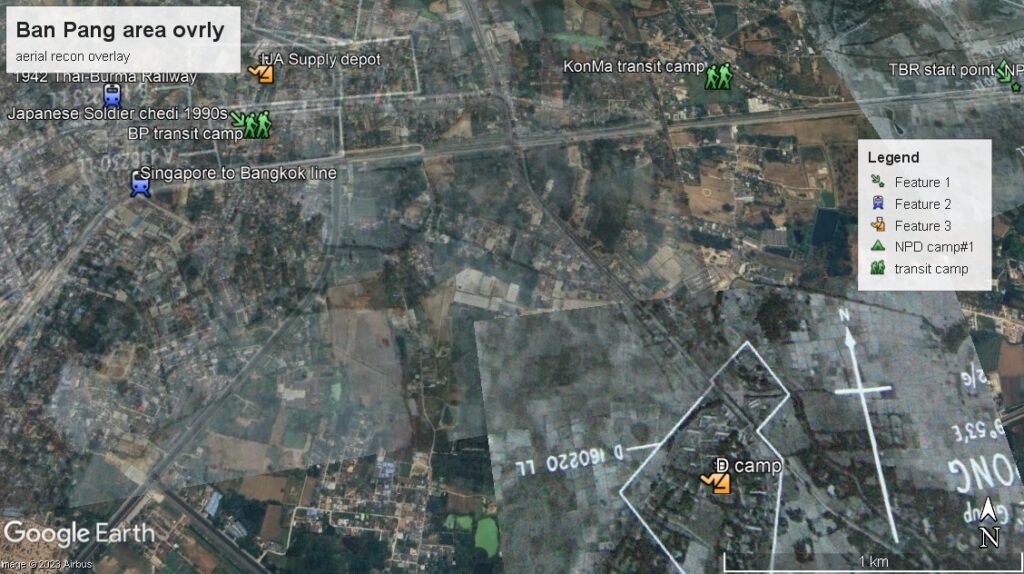
Then comes the BanPong (Wat Don Toom) transit camp and the adjacent IJA facilities. In this latter rendering, it can be seen how 3 different recon photos nearly overlap.
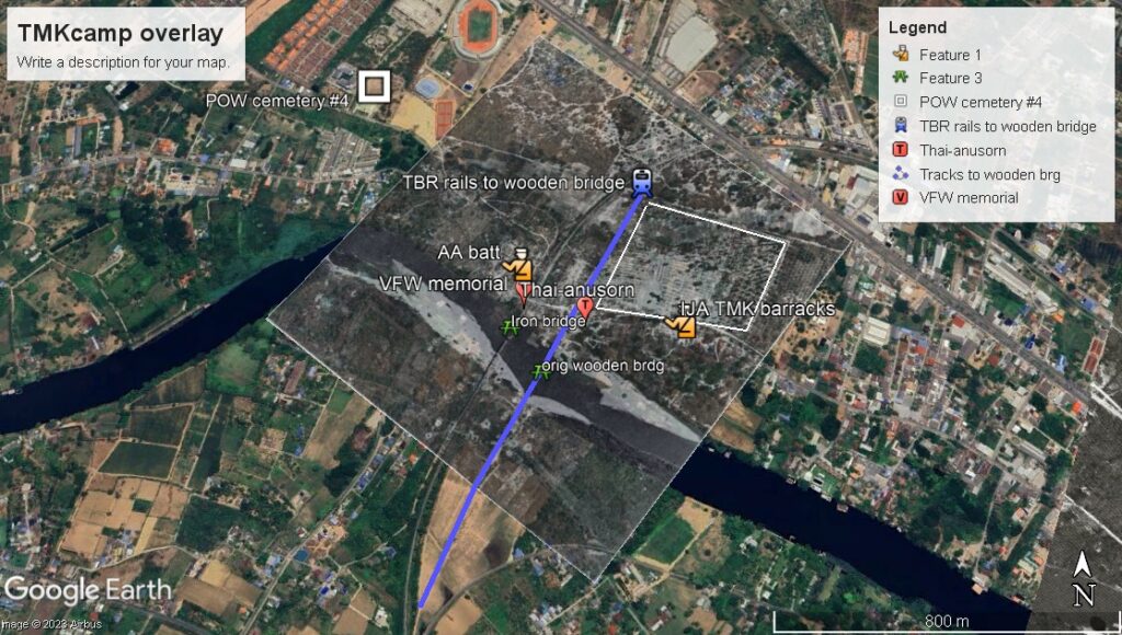
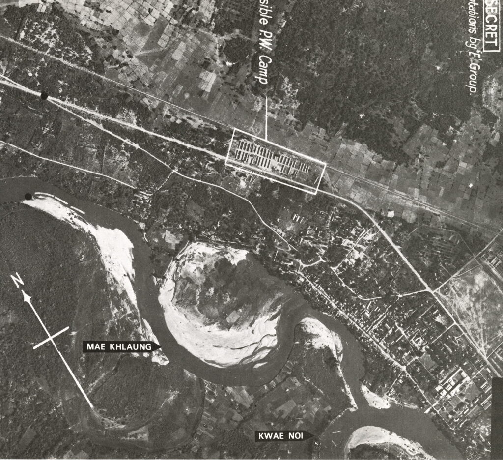
Aligning the photos of the ThaMarKam camp was easy using the existing Bridge. This then allowed for the precise path of the tracks to the wooden bridge to be located and marked. It is quite amazing that after 80yrs the trace of that path on the opposite side of the river is still discernible. One can clearly make out the bomb craters in the immediate bridge area.
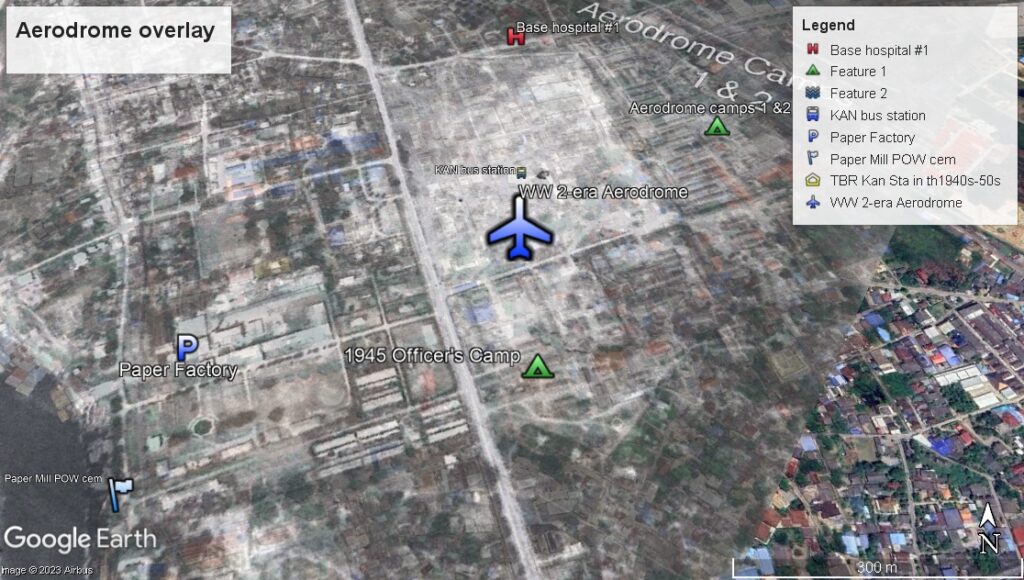
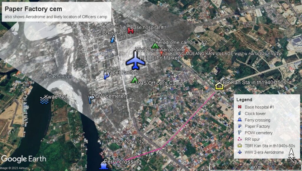
Near the center of the current city was the Aerodrome. The era photos reveal that this was likely never targeted for bombing. It was simply a large open expanse cleared of any obstructions. There was no actual runway. Bombing would have had little effect on operations. It is thought that this was primarily a supply base and did not permanently house any combat aircraft. Interestingly, the current bus station lies in almost the direct center of this airfield. The adjacent Paper Factory (dating from the mid-30s) is evident as well.
But the most enlightening area is at the current Don Rak war graves cemetery. I believe that this one photo (although undated) solves a debate over where some of the original burial sites were located.
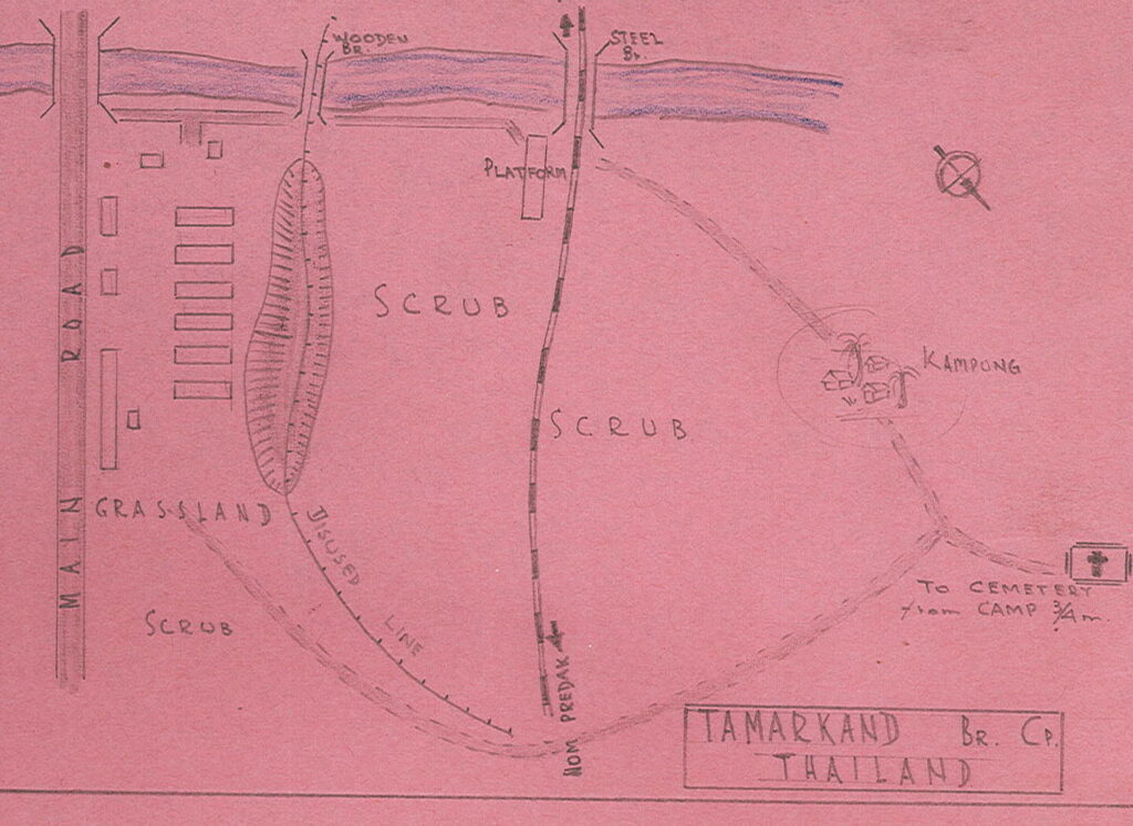
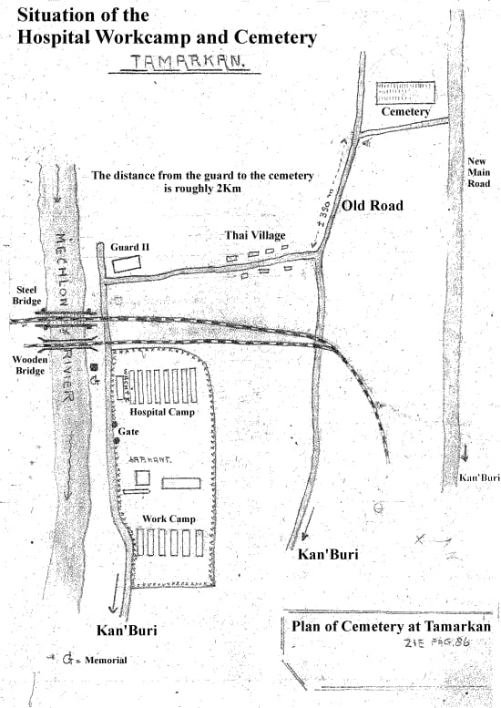
For this I need to provide some background information. In the immediate post-war months, an Australian Lt. FLAWS drew up a series of maps (rendered herein in pink) that assisted the searchers in recovering the remains of the POWs buried along the TBR route. He was, I believe, a member of F Force. So he was drawing maps of places were he, himself, had not likely seen. He apparently was astute enough to have gathered information as to these locations from many other POWs and sources. Along the way, he made some errors. For example, in locating the graves north of the ThaMarKam camp, he adds a non-existent road bridge across the river. It wasn’t until decades after the war that any such bridges were constructed. There are other small errors that place the precision and accuracy of his work in question. There is no doubt that he was mostly correct in his mapping, but the errors leave certain aspects in question. It also reinforces the idea that that he has not intimately familiar with all the sites he was mapping.
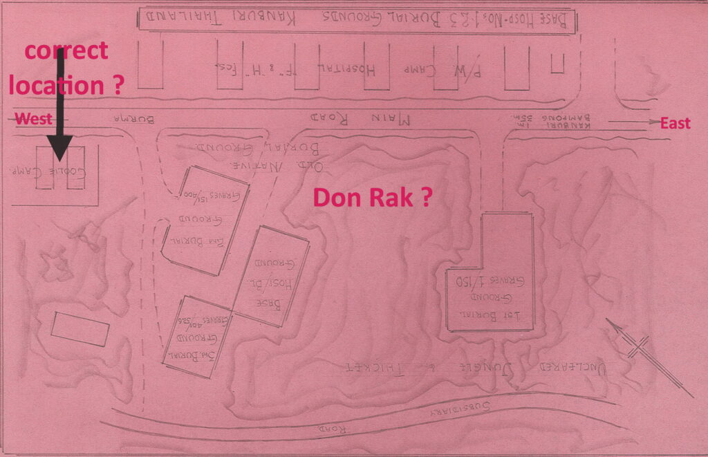
We turn now to one specific map; that of the eventual Don Rak area. He places four different burial sites in that area across the road from the F&H hospital #1.
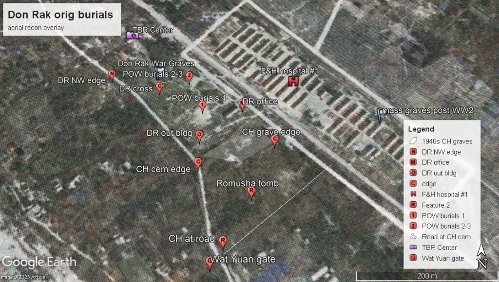
We know for sure that Don Rak was immediately adjacent to this facility. But when overlaying the photo there was a surprising find. The current cemetery is off-set to the north by about 50% or about 100m. It is not precisely aligned with hospital site. In the (undated) recon photo, we can see two patches showing as white areas. From viewing all the other such photos these stark white areas always seem to match ‘disturbed land’. In the war-era most of the immediate Kanchanaburi city area was scrub land with scattered trees; the latter showing quite dark on the photos. Not surprisingly, these two areas of ‘disturbed land’ fall into the east end of the current Don Rak cemetery.
The one that FLAWS labels as “1st burial ground” of 150 graves is between the current Don Rak office and outbuilding. The second area described by FLAWS as three separate burial grounds is more towards the center of the current cemetery. The NE half of the current cemetery was ‘undisturbed’ land in this photo. Whatever building FLAWS depicted (to the left of the drawing) is not present. The simple fact that he denotes “uncleared jungle thicket” but fails to mark the presence of the temple that existed in that area further attests to the sparsity of the information he was working with. Furthermore, he seems to have gotten the location of the ‘Coolie camp’ wrong as well. Although we (as yet) have no photos to show its location, we have every reason to believe that it was east (not west as he draws) of the hospital and extended almost to the Aerodrome.
Using readily discernible land marks like the nearby intersection and the slight Z-shaped trace of the road to the south of the cemetery, it is easy to precisely overlay the recon photo on the current map. I firmly believe that this then depicts that four of the original burials sites in the area were on the current Don Rak site.
The one original burial site that everyone seems to agree on is that just north of the Bridge. There are multiple maps showing its location — including FLAWS 3-bridge map and the diagram shown above.
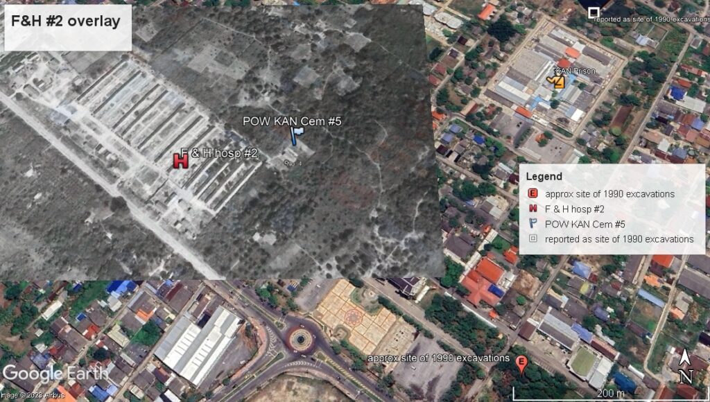
Another recon photo helps to place another cemetery site immediately adjacent to the F&H Hospital #2 that sat on the site of the current hospital near the traffic circle on SangChuto Road. This area is also significant in that it is where hundreds of romusha graves were excavated in 1990. It is believed that a second romusha camp was located just to the east of this hospital complex as well. I have marked the Lat/Long coordinates listed in an article that identify the precise location of that excavation. It seems to be within the confines of the Governor’s office complex. At the time of the excavation in 1990, this area was, however, described as a privately owned sugar cane field;so the Lat/Long cited might not be accurate. This will take more investigation to elucidate.
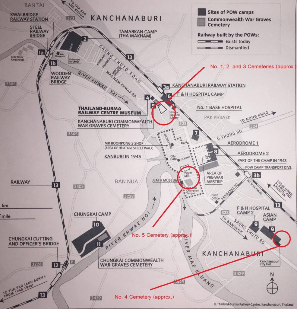
There seem to have been at least 6 and possibly as many as eight cemeteries in the Kan City area. A map by Rob Bettie of the TBRCtr depicts 5 such sites. The one he labels as #5 (there is no agreed upon designation of these sites) is in the exact place as the original JEATH museum on the river bank behind the Paper Factory. His other labels agree in general with what is described above. Lt. FLAWS correctly places this burial site as well.
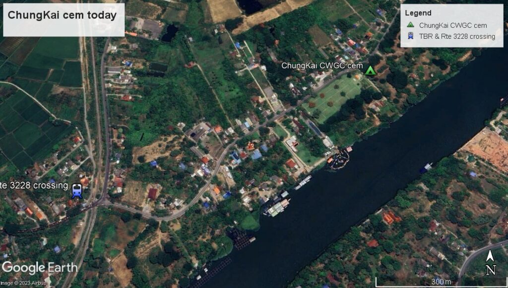
The ChungKai camp overlay shows the site of the camp that served as the first true POW work camp and then transitioned to a huge hospital camp.
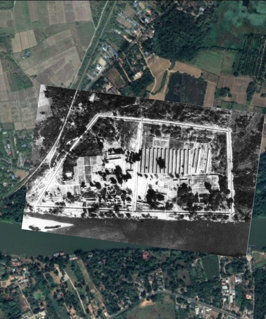
There were reportedly two cemeteries at ChungKai generally referred to as north and south. Under the auspices of the CWGC, these were consolidated and moved slightly inland to avoid annual flooding.
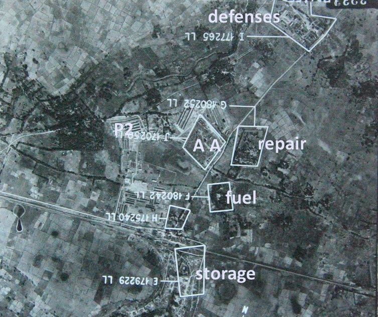
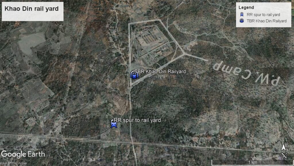
The last of the overlays does not involve a cemetery but rather the large rail and and repair facility at Khao Din just east of the main Kan City today. This overlay was a bit harder to place accurately due to a lack of usable landmarks, but I believe it to be reasonably accurate. There seems to be no trace of the spur that led from the main track to the rail yard or any of the roads in the area in the 1940s.
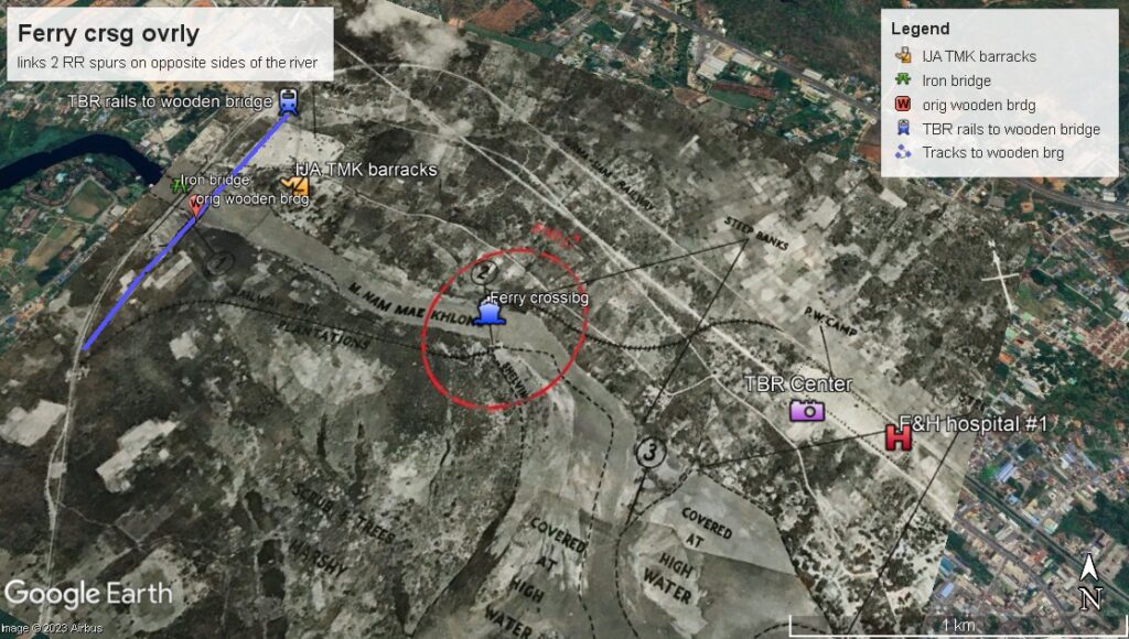
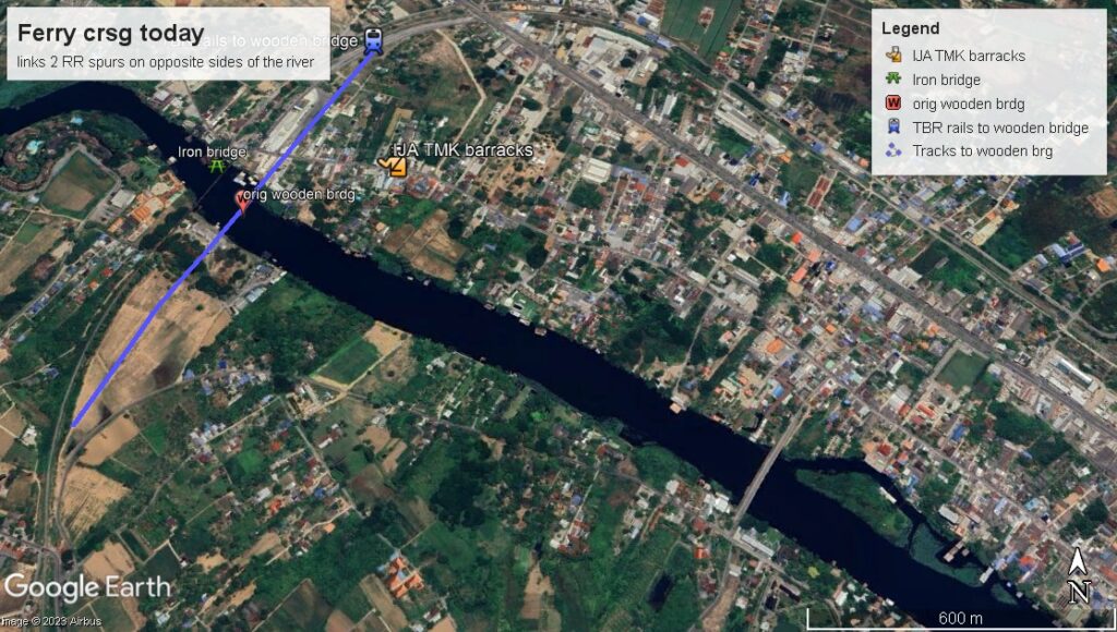
Below is a KMZ file posted by Stefan Zingg another TBR enthusiast. In it he has painstakingly reproduced the RR spurs leading to a ferry crossing. Today the spur on the south shore is overlain by a road leading from a bridge in that same spot.
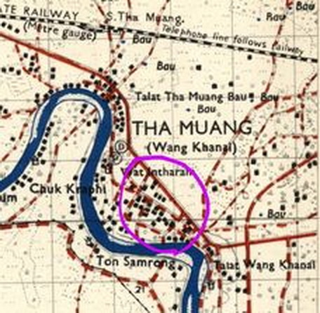
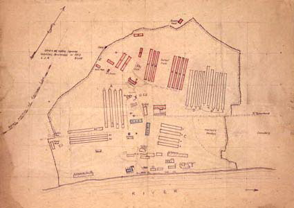
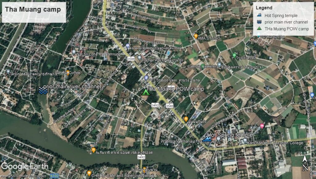
A transit camp was established at Tha Muang roughly 17 Kms east of the Bridge. It was a rest stop for those marching from BanPong to their assigned work area. Post-war, that camp was expanded to house a large number of Dutch (former-POWs) who, due to political unrest, were unable to return to their homes. They describe using the hot springs at the nearly temple. There are no available recon photos since this area would not have attracted the attention of the bombers. It is also interesting to note that the long bow in the river was the original main channel. It was reduced in significance when the electricity-producing dam was built and the straighter channel dug through.
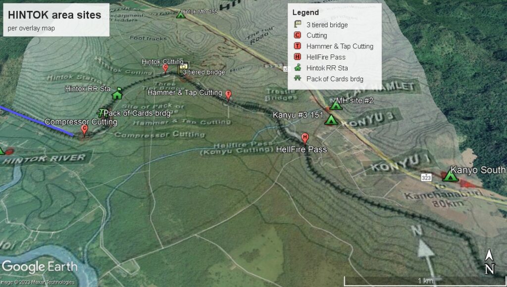
The folks at the ANZAC Portal webpage produced an amazing detailed map that also appears to be quite accurate;
I was able to overlay it onto GE and it fit the road line and river bend precisely. Once properly aligned, the precise location of the more infamous parts of the TBR and the location of the Hintok area camps could be indicated on the satellite view. Viewing it with the TERRAIN feature turned on literally adds a new dimension to the TBR path as it skirts then wraps around the large hill on the left.