A semi-historic tour of ‘Kanburi’
Obviously the two most visited sites in KAN are the Bridge and the CWGC cemetery. But you can take a quick tour of some other less well-known sites in the city.
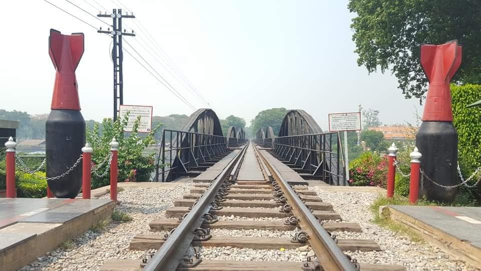
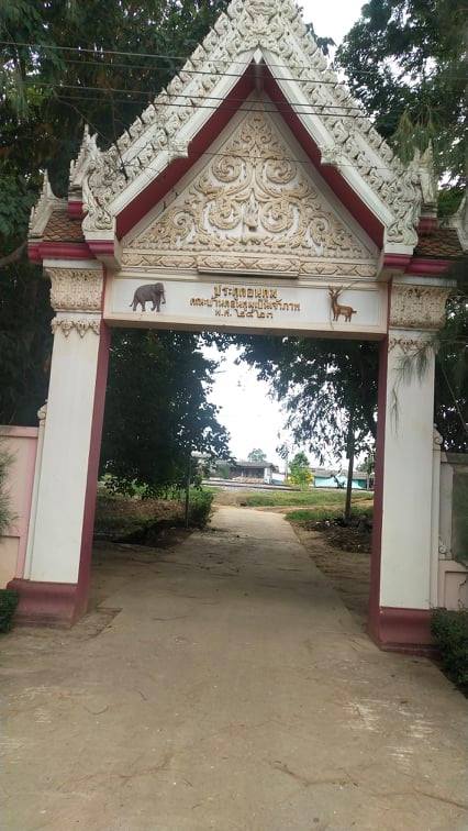
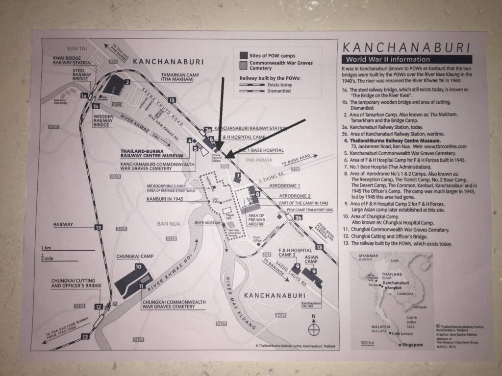
If you start at the bridge drive down the road that is closest to the river. This will take you through the back-packer haven of bars and cheap hotels. Immediately below the market area of the bridge you will have passed the Thai-anusorn Cenotaph memorial to the POWs and Asians who died on the TBR. The interesting fact is that the tracks to the original wooden bridge passed immediately next to this monument on the bridge side. Modern development prevents you from seeing or walking that area but you are on historic ground in front of the City Hotel.
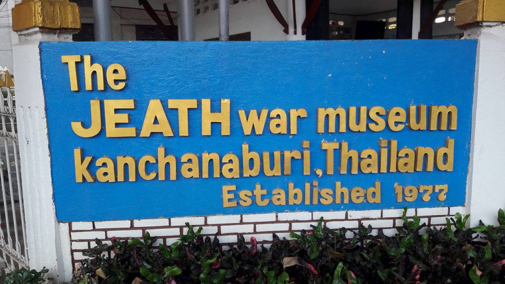
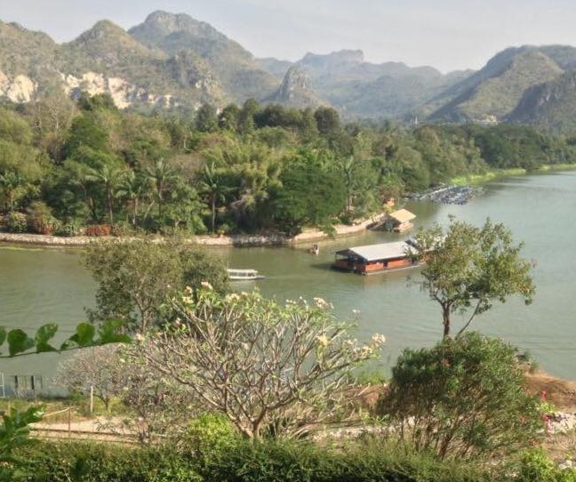
At the end of the ‘walking street’ area the road takes a jog to the left. Take the first right turn. Soon you will be passing behind the main cemetery at Dom Rak. The map calls it Holanda Rd, but I’ve never noticed a street sign. Continue parallel to the river; pass the turn that will take you over to the ChungKai cemetery (small green sign). Continue straight entering the narrow lanes of the market area of the town. Take any right turn and move towards the river turning left onto Pakprak Rd. Soon you will arrive a wide plaza; this is the early city center. You can spot remnants of the old Kanburi city wall. Next on your left will be the now abandoned and derelict Paper Factory buildings. Immediately past that on the right is the original JEATH museum; well worth a stop. You can park in the temple and that too is worth a few minutes of your time to explore after the museum. You can get some good photos of the river from the temple area on the river bank. At this point, you have reached the lower end of the old city area. You are looking west at the confluence of the Kwai Noi as it meets the Kwai Yai (coming down from your right) to form the Mae Klong River.
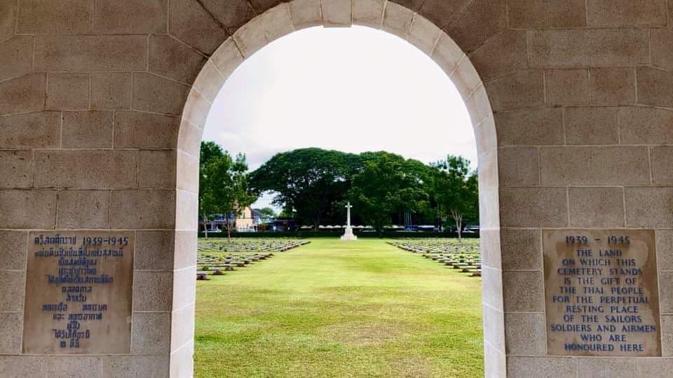
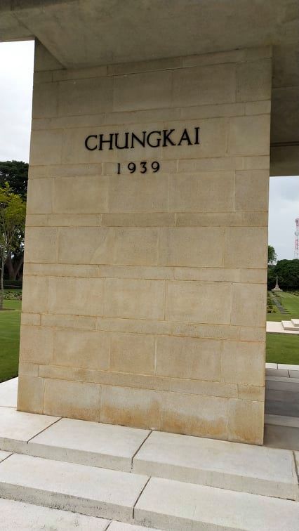
Now it’s time to visit ChungKai and Khao Poon. Back track from the temple / museum and turn at the first left. On this lane you will find a series of raft restaurants anyone one of which is fine for lunch. Just don’t expect much English to be spoken or even written on the menus! Continue back towards the main cemetery and make the hard left turn up onto the Rte 3228 bridge. When you come to the T-intersection, turn right. A few kilos down the road the CWGC cemetery is on the left. Truthfully, there is not too much to see or do there, except to remember the dead and that you are standing on the east edge of the ChungKai POW camp stretching off beyond the back wall of the current cemetery. Some of the US POWs spend time at the ChungKai camp as well at at the larger ThaMarkam camp.
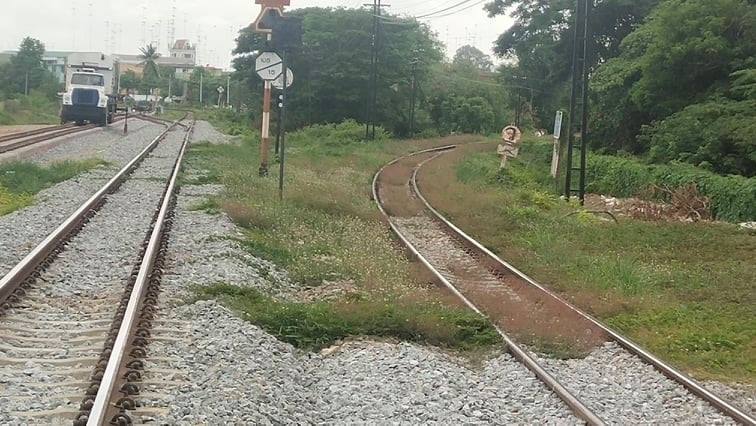
Back in your vehicle and drive another kilo or so. Instead of crossing the TBR tracks, turn onto the dirt road before the tracks. The roadway immediately drops down to the river level. On your right is a 10m high embankment that the British POWs at ChungKai built. There is a rather dilapidated restaurant on the riverbank — I don’t recommend to patronize them, but that’s just my humble opinion! There is construction going on for what looks like a small resort, but from the restaurant area you should see a set of steps for climbing the berm.
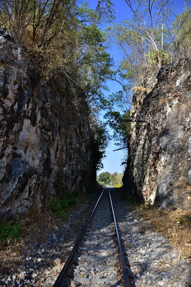
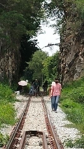
As you reach the top of the embankment, stop and ponder the huge amount of labor it took to build that embankment shovel by shovel. To your left is the first of the Khao Poon cuttings through a limestone outcropping that blocked the surveyed railway path It is the same concept as Hellfire Pass except on a miniature scale. Off in the distance is the second cutting, but in order to reach it while walking the track you have to cross a rather rickety bridge with no side rails. Not my cup of tea.
After you shoot your pix and contemplated the ordeal of those POWs, go back and turn left crossing the rails. A couple Kms down the road as you ascend a hill, the entrance to Wat Tham Khao Poon will suddenly appear on your left. If you miss it there is a second entryway just a bit farther on. This temple is a popular weekend get-away site for Thais so it can be very crowded.
Drive through the main section of the temple and ascend the hill. Ignore the NO ENTRY sign and continue to the top of the hill. There you will find not one but 2 modern coffee shops catering to the 20-somethings taking selfies. But what you want to find is the second cutting. It is at first hard to tell but you are standing right above it on the limestone outcropping that the POWs sliced thru. There is a path and a stair case leading down to the tracks at the river level. Immediately on your right is the second cutting and off to the left the one you just departed from. More photo ops at the cutting and the bend in the river.
If you are truly an intrepid spelunker you can take your chances by returning to the front of the temple area and paying your admission fee to see the cave system. WARNING: do NOT enter if you are more than a bit overweight or out of shape.
What they fail to warn you about is that after a very leisurely gently sloping walk into the cave, when you get to the low point, there is a crack in the stone that cannot be more than a half-meter wide that you must pass thru to continue. Our 10yo guide ran thru, we struggled to twist our bodies squeezing them thru the gap! Then comes the hard part. The exit is a series of not very well constructed stairs rising more or less straight up! They are steep and narrow with no real place to stop and rest. There must be a thousand steps – well maybe not quite — it just seems that way. Winded and weary you return to the sunlight and then have to walk another half-kilo around the mountainside to get back to your car. Or you do what I did and send the driver to fetch the car while you recover in the shade of the pavilions conveniently placed there. Not a horrible experience but not one that I will repeat!
Depending on the time of day, you can choose to end your journey into history here or continue down the road to three more quite unique temples in the next 20 or so kilometers. I have described that day-trip in a different presentation.
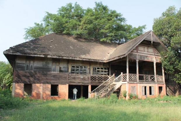
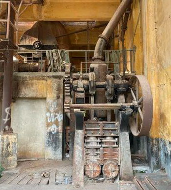
The Paper Factory (mentioned above) is one of the few remaining buildings that we can date back to the POW era. It is now abandoned but still stands near the old walled city. It figures prominently in British ex-POW John Coast’s account of his post-liberation revelry in KAN and I am told it was the site of some of the filming for the movie version of THE RAILWAY MAN. Built in 1935 by an unknown German engineer, the paper mill was operated by the Thai Army and produced pulp and paper for the country to print its own banknotes during World War II. [see Section 11.3 for its story]
https://www.bangkokpost.com/travel/1594982/paper-mill-campaign-binds-kanchanaburi-community
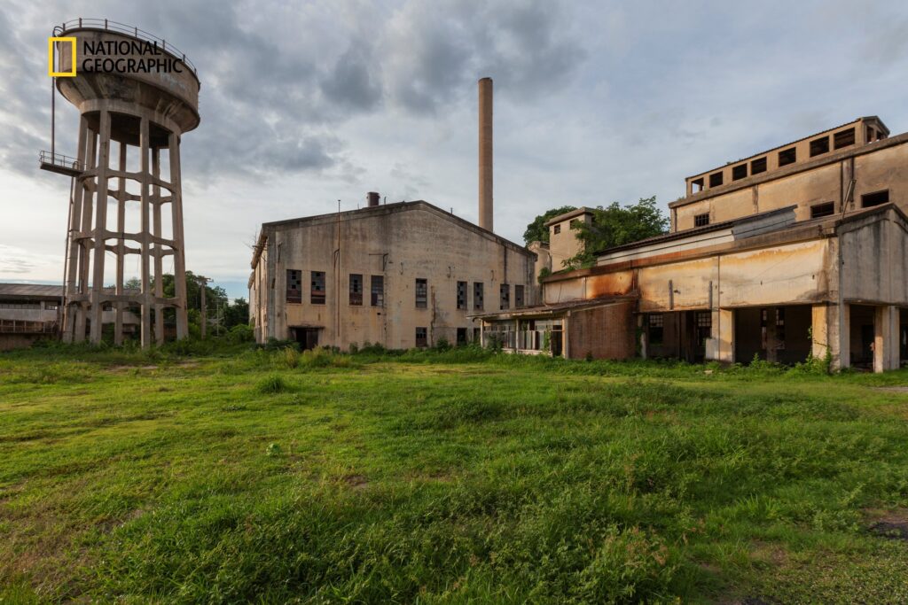
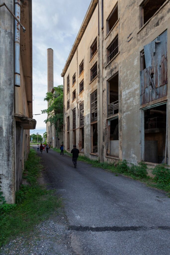
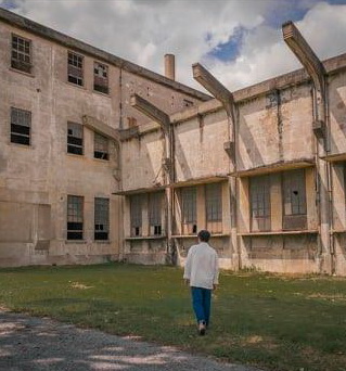
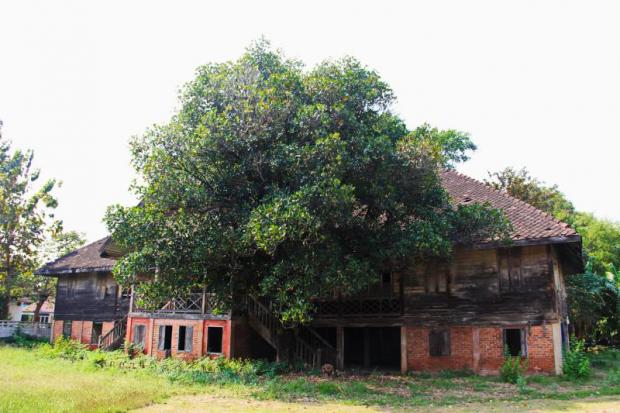
From the outside, the paper mill resembles any run-down warehouse. But the factory once has seen some glory days.
It was the first place to have a television in the province, and its compound once had a tennis court, clubhouse and beautiful architecture. People in the area were accustomed to the sight and sound of chimneys and boilers from the factory until it closed in 1982.
For the local community, the mill is more than just a photogenic vintage factory. It tells a story about the changing face of the province over the last century. One resident said: “This place is a hidden gem. But it is only known about by local people. Tourists do not know much about it. However, the site has huge potential. It would be an ideal site for a local museum and community hub.
https://www.thailandphotomap.com/2019/12/01/weekend-train-trip-to-kanchanaburi/
A pictorial of the River Kwai Bridge by Richard Barton (with permission if the author)
Part 2: A Virtual Tour proposal
Telling the story of the TBR in a coherent way is difficult in that it extends over 412 Kms in two countries and involves men of many nations; as well as levels of horror and deprivation unheard of in other parts of history. It is not an easy task.
Perhaps using modern technology, it could be done as a ‘virtual tour’.
Such an excursion could perhaps best be accomplished by utilizing drone footage to place the specific site in context then supplemented by video / photographs to highlight the pertinent items. Most of the cited points along the way would have a ‘historical marker’ that would place that specific site in the larger context of the TBR and give the visitor a link (likely via a QR code) to the website of the full story. In this way, a visitor who found any one site would be linked to all.
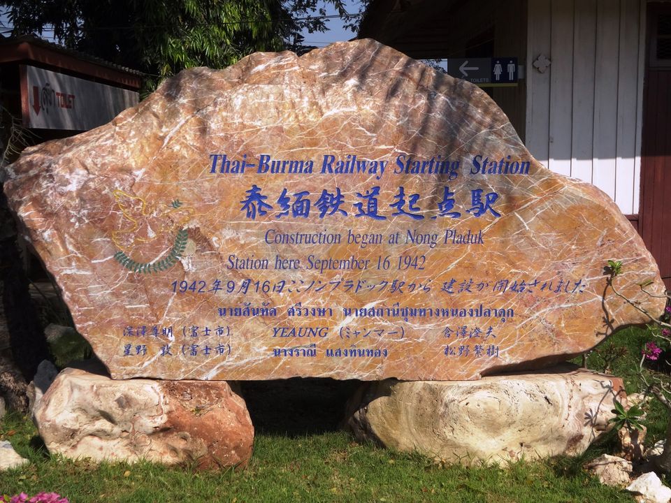
Such a tour would logically begin at the true beginning of the TBR at NongPlaDuk Junction. This would highlight the stone marker; introduce the concept of a witness tree and perhaps briefly discussion of the adjacent POW camp and cemetery.
Site 2 would be the “Gate to Hell” at Wat Dan Toom. Drone footage would show the 3 Km of track from NPD then the approach from Singapore; finally the sweeping turn away from BanPong to the west.
The Ban Pong Incident that ended the direct Thai involvement in the TBR could be inserted here.
The 50 Km path to KAN could be shown in as far as it runs over flat, open, unobstructed agricultural land.
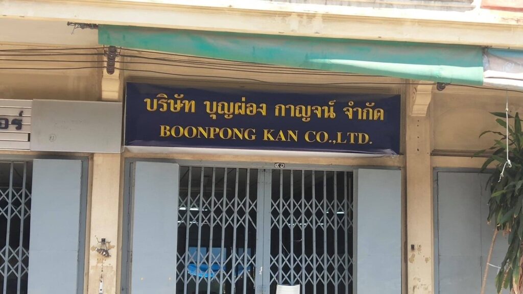
Next, a combination of maps and drone footage would introduce the large cluster of sites within the city of Kanchanaburi itself. The first physical period-specific location would be the BoonPong house / museum (site #4).
Locations 5 -7 are the JEATH museum, Don Rak cemetery and TBRC. Added here could be the (soon to be dedicated) romusha obelisk and information about the huge camp occupied post-construction by the POWs and romusha.
Cluster 8 centers on the Bridge and the 2 plaques (the relief map and the VFW memorial) also noted would be the nearby 1944 IJA shrine (site #9).
From there we jump forward to ChungKai and discuss the cemetery and the camp that occupied that place.
Just past CK is one of the more interesting series of locations (IMHO) in that the area controlled by the SRT and Wat Khao Poon contains examples of the three most common tasks needed to build the Railway: a berm; limestone cuttings and bridges.
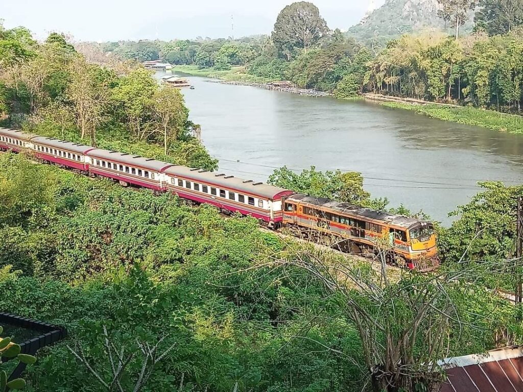
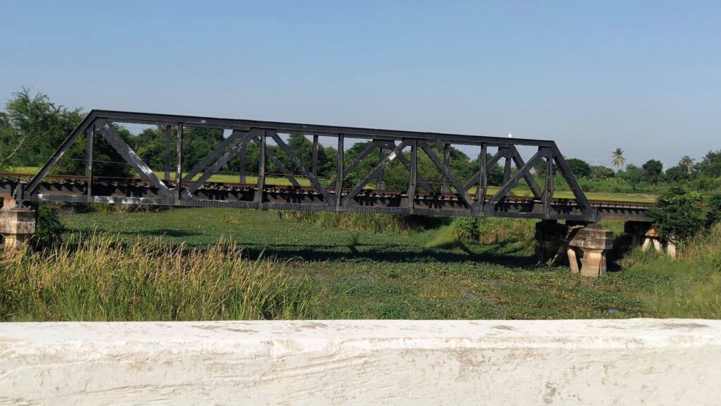
Site 12 is the Wang Po trestle and the tourist train that traverses it. This leads us to show the 70 Km path of that train from the Bridge Station to NamTok. This passes a number of known, but no longer marked, TBR construction camps.
Finally, we end this virtual tour at HellFire Pass as site #14.
To my mind and psyche, the two most emotion-laden and evocative sites are the Don Toom transit camp (site #4) and HellFire (#17).
I will bring attention to the fact that there are 3 other potential sites that I have chosen to ignore. These are 1) the JEATH 2 ‘museum’ near the bridge; 2) the Kuang Im Chapel and 3) the Nationalist Chinese Soldier memorial adjacent to it. IMHO, none of these deserve a place in the TBR saga.
It also seems appropriate that we conclude this tour at the 140 Km point at HellFire since there is little of a physical nature beyond that point that is recognizably part of the TBR; plus the 140 Km distance is about the limit one could expect visitors to encompass during the relatively short time that most dedicate to this tour.
Certainly any companion website that strives to relate the full story of the TBR would need to continue the narrative, but supplemented by photographs as opposed to video.
The beauty of using a device like a QR code to link the visitor to an external source of information (a website) is that having located any of the sites that visitor is now linked to the full story and can see the significance of any one site in the larger context of the entire TBR. Plus, once acquainted with that external site, they could revisit it at their leisure to expand their knowledge and perhaps to plan subsequent visits to new points along the route.
The Social Scientists use words like horror tourism and atrocity heritage when they discuss the Death Railway. Because of the unique nature of the TBR, I would suggest that such a tour as is being suggested herein concentrate on the physical objects and the geography of the TBR and seek to avoid direct references to the horror and atrocities involved. This is obviously sanitizing the saga but the ‘sensitivities’ of the individuals and nations involved needs to be considered. I’d suggest that the interested visitor could follow up on the minimalist information provided on such a tour to further delve into the horror that was involved.
For the most part, the worst conditions experienced by all involved began at HellFire Pass. Not that the prior 140 Kms of construction were without tragedy, but compared to HellFire and beyond they were quite benign. Similar circumstances prevailed in the Burmese sector. The first 50+ Kms out of Thanbyuzayat were laid over relatively flat open country primarily by ‘hired’ Burmese workers. After that, the terrain began to rise and the amenities of roads and villages all but disappeared. The closer the construction crews got to Three Pagodas Pass (at a height of 300 meters) the worse the conditions got in both sectors.
On the Thai side, as the Railway arrived at HellFire it began to veer inland away from the Kwae Noi River that was the vital passageway for supplies. Conditions rapidly declined for all concerned.
It was also at HellFire that we have the first documentation of large numbers of romusha being involved. The additional burden of these tens of thousands of bodies was more than the feeble supply chain could bear. Add in the cholera outbreaks and one is truly looking at hell on earth! By stopping this tour at HellFire, we have yet to arrive at those camps where the greatest amount of deprivation occurred. By doing so, we avoid relating the tales of horror that occurred in the Highlands area of both countries. Perhaps this sanitized version will better suit the sensibilities of the modern tourist!
Placing all of the atrocity in the background for the moment, I do believe that the IJA Railway Engineers deserve some recognition for what is truly a spectacular engineering accomplishment. It may not have been their choice to build the Railway over the bodies of the workers, but they designed and built a functional (if rickety) Railway in record time and using some outstanding engineering. We cannot relate the saga of the TBR without recognizing the contribution of the various survey crews who literally marked every meter of that 412 Kms and planned the work-arounds (cuttings, trestles and bridges) that linked NongPlaDuc to Thanbyuzayat.
| sequence | at KM | OWNER | active railway | |
| 1 | 0 | NPD stone | SRT | safety |
| 1.1 | 0.1 | NPD camp | private | |
| 1.2 | 0.2 | NPD cem | private | |
| 2 | 3 | Wt Dan Toom gateway | TEMPLE | safety |
| 2.5 | 3.3 | BanPong station | SRT | safety |
| 3 | 44 | 50km of rails | SRT | |
| 4 | 50 | BoonPong hse | MUSEUM | |
| 5 | 1997.1 | JEATH museum | MUSEUM | |
| 6 | 1949 | Don Rak Cem | CWGC | |
| 6.1 | 2022 | Romusha oblelisk | TEMPLE | |
| 7 | 2003 | TBRCtr | MUSEUM | |
| 7.2 | 52 | POW/romusha camps | TAT | |
| 8 | 55 | BRIDGE | SRT | safety |
| 8.1 | 1997.2 | 2 plaques | TAT | |
| 9 | 56 | IJA shrine | MUSEUM | |
| 10 | 1948 | ChungKai cem | CWGC | |
| 10.1 | 57 | ChungKai camp | TAT | |
| 11 | 60 | Wt Khao Poon | TEMPLE | safety |
| 12 | 115 | Wang Po trestle | SRT | safety |
| 13 | 120 | 70km of rails/camps | SRT/TAT | safety |
| 14 | 150 | Hell Fire Pass | MUSEUM |