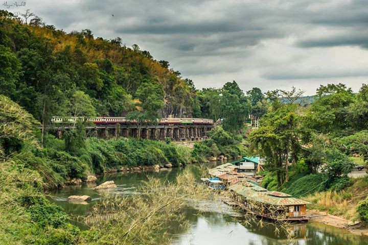
Japanese Railway Engineer Futamatsu describes his wonderment and fascination when he first glimpsed the limestone outcropping at what he calls Arrow Hill and today is known as the Wang Po. He was on a boat traveling upriver to visit the surveyors who were marking the TBR path. He says that he immediately was driven to make sketches of the trestle that would have to be built to circumvent this obstacle. About 50 Kms farther back, at Khoa Poon (near the current Chung Kai CWGC cemetery), the engineer teams had to make to small ‘cuttings’ through similar limestone, but this was the first major obstacle that the TBR encountered at about the 111 Km mark. Records say that this 400 meter [1] multi-level trestle was completed in about six weeks by 2000 British POWs.
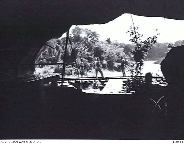
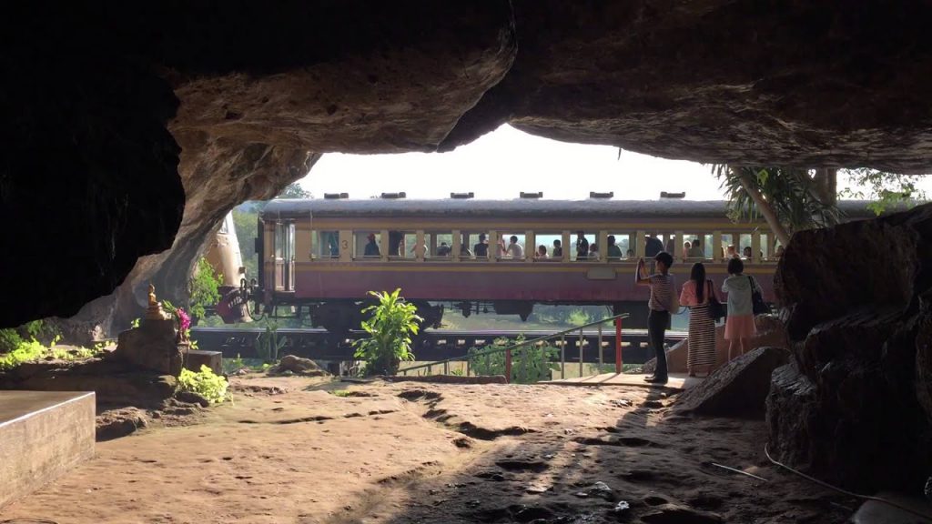
Since the portion of the railway beyond Kanchanaburi was reopened in 1957, the Wang Po stop has become one of the most popular for the tourists. The daily trains, carrying almost exclusively tourists, continue on for another 10 Kms or so to Nam Tok (known as Tarsau to the POWs) before returning to Bangkok via Kanchanaburi. Rather than ride to Nam Tok many tourists get off at Wang Po and explore the market place, the trestle, the nearby cave which today contains Buddhist statues but was used by the Japanese as a shelter and for storage. Certainly, this trestle / viaduct is one of the most photographed places in all of Thailand.
[1] It is worthy of note that while this trestle/viaduct is 400m long a similar structure at Tha Kanun was 600m. That was dismantled post-war.
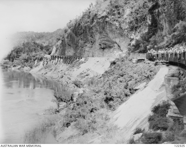
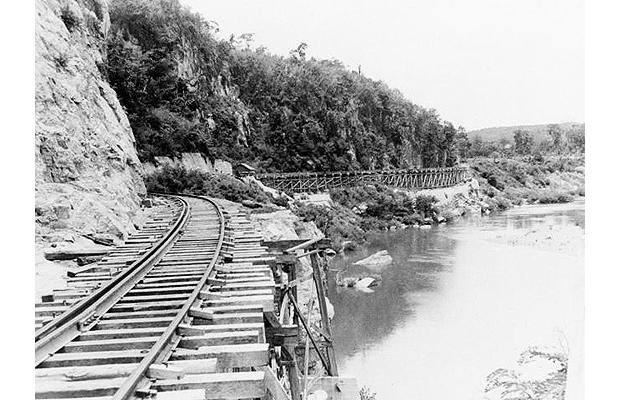
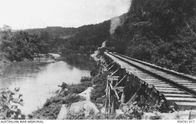
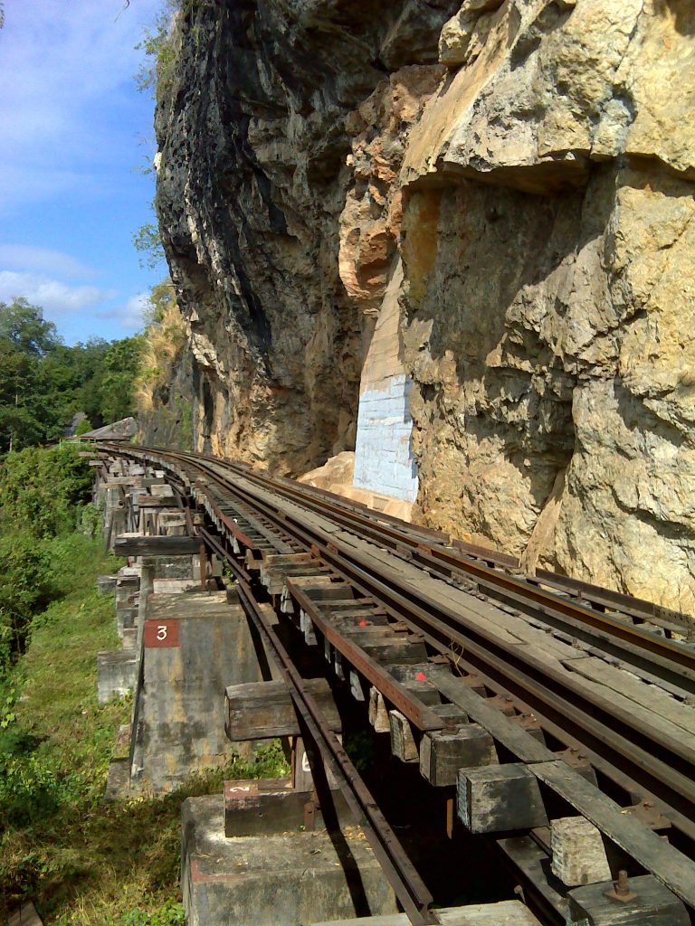
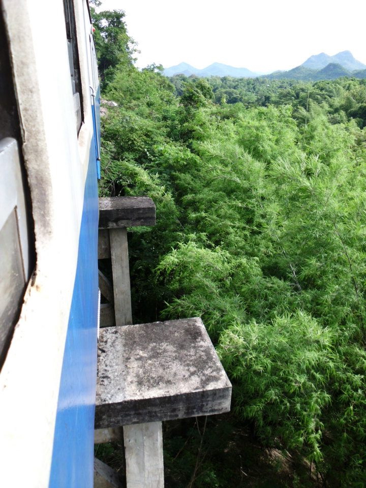
Before building the viaduct that seems to hang off of the mountain, the POWs had to carve a ledge or shelf along the western portion. This provided a base on which to set the trestle.
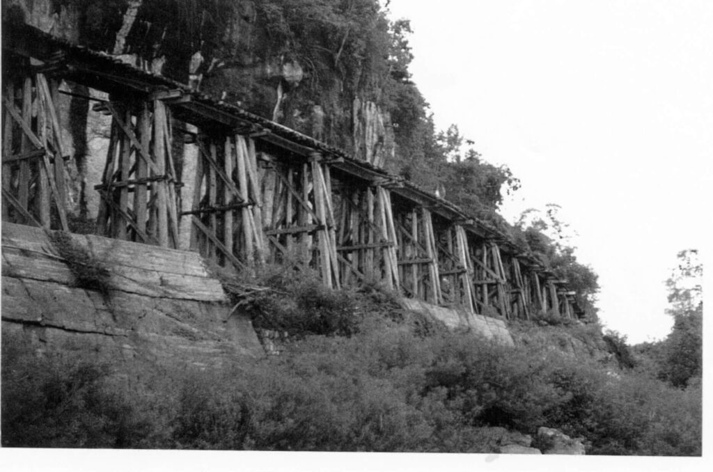
The IJA Engineers were very experienced at railway construction. They were less confident in the workers that they were supervising. Given the slave-like status of the workers, the Engineers were constantly on the lookout for sabotage. It is said that after the completion of this trestle, some POWs were placed on a flat car that was pushed (not pulled) by a locomotive. This was the Engineer’s way of testing the integrity of the structure before it was placed into use.
This huge limestone outcropping that abuts the river runs for miles to the north. There was simply no way to go around it except along the river. The Engineers needed workers beyond this point while the bridge at ThaMarKam and the trestle here were being built. They mapped out an overland route around this mountain. As is pointed out elsewhere, the IJA guards used barges and boats to move supplies on the Kwai Noi river. It was easily navigable beyond this point. But workers were never carried upstream, only supplies. Those returning boats would later ferry the sickest men to ChungKai or other ‘hospital’ camps, but never deliver them.
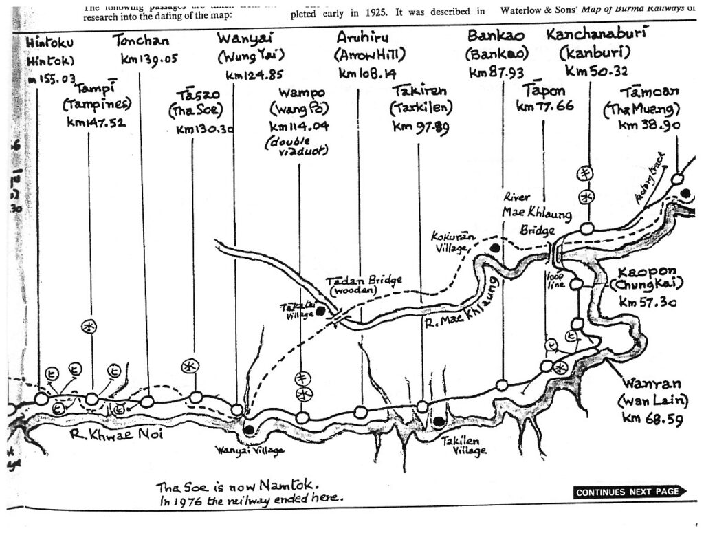
IJA Chief Engineer Futamatsu tells us that brief consideration was given to using the Tadan site to cross the Mae Klong rather than building the bridges at ThaMaKam. But this alternative was rejected in that the road — shown roughly by the dotted line — was deemed to be nearly impassible during the rainy season. The route paralleling the river was chosen in order to use the river as a main supply channel. This likely was a very good choice in that the lack of any such river and the need to send supplies overland in the Burma Sector led to many transportation issues during the monsoons.
Per the map above, workers trekking to their assigned work places would continue west from Kanchanaburi to LatYa then cross the Mea Klong River at Tadan. It was then about a 12 kilometer journey back to the Kwai Noi River, but they were past this major obstacle.
Modern day Update: The Wang Po viaduct is second only to the Bridge in terms of numbers of visitors. It is not unusual on social media posts to have photos of the viaduct along side those of the Bridge. A few mis-informed individuals go so far as to identify the viaduct as the Bridge. Hopefully this is simply the product of a long day’s excursion in which many photos were taken and an eagerness to get them on their favorite outlet and not a true confusion of the two entities. [see Section 1.2]